Free Practice Questions for the Esri EADA EADA10 Exam (2026 Updated)
At Marks4sure, we are dedicated to providing IT professionals with the most accurate and reliable preparation materials for the Esri EADA10 exam. To support your certification journey, we have made a selection of our premium 2026 EADA practice questions and answers available completely free. You can take this practice test as many times as you need. Every question includes a detailed, expertly verified explanation to ensure you fully grasp the core security concepts before test day.
An ArcGIS user has an .mxd file with layers referencing data from ArcSDE.
What should a user do to check the ArcSDE geodatabase versioning information of a layer ' s feature class?
An ArcGIS user needs to display a point file as graduated symbols on a map, based upon the number of occurrences. The point file contains multiple points with exactly the same x- and y- values.
Which process should the ArcGIS user perform prior to symbolizing the data?
A client requests a map of a project area and wants to view the data in ArcReader. What is a valid way for the ArcGIS user to share the project area with them?
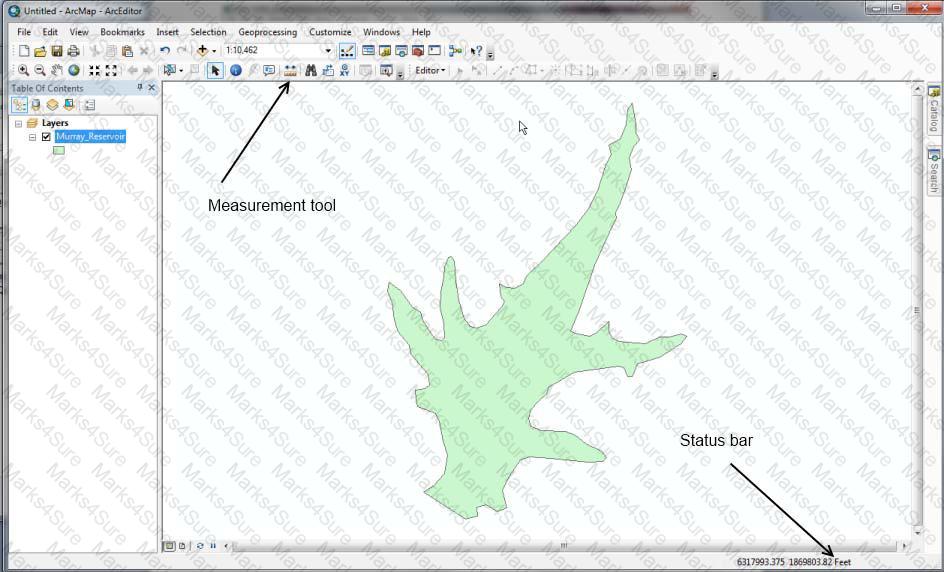
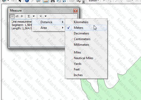
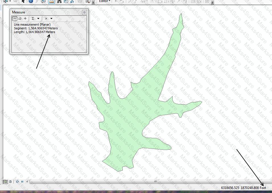
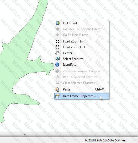
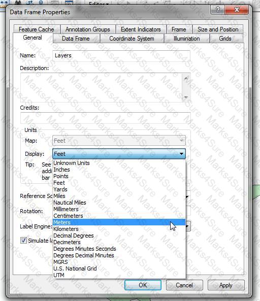
An ArcGIS user is viewing a feature layer that is being displayed in a projected coordinate system that uses meters as the units. The user needs to see the map coordinates displayed in the status bar as nautical miles.
How can the units be changed without changing the coordinate system?
An ArcGIS user is displaying a parcel feature class under a building feature class. The user wants to ensure that the exact outline of all features is visible.
What must the ArcGIS user do to allow both feature classes to be viewed at the same time?
An ArcGIS user performs a spatial adjustment on a dataset.
Which two factors can be used to determine whether the results are acceptable? (Choose two)
Given a layer called Counties with the following relevant attributes:
POP2008
POP2000
STATE_NAME
What is the correct WHERE clause syntax for Select by attributes tool that should be used to find all the Counties with a population greater than 50000 and less than 100000 in state of Florida in year 2008?
An ArcGIS user creates a locator from a polyline feature class that exists in a feature dataset.
Where can the locator be saved?
How does a geodatabase topology ensure data integrity and maintain the spatial relationships between features?
Which effect does applying a join in ArcMap to a layer and a stand-alone table have?
An ArcGIS user would like to share an .mxd file with another co-worker without impacting the symbology of the layer.
Which two files can be sent to ensure the symbology is maintained? (Choose two)
An ArcGIS user is analyzing an earthquake dataset to investigate the relationship between magnitude and duration of incidents. The user displays magnitude on an x-axis and duration on a y-axis.
Which type of graph is the user employing?
An ArcGIS user creates a model that includes the Clip tool and wants the x.y tolerance set as 500 feet in the environment setting.
What is the minimum environment setting level to override the default settings?
An ArcGIS user performed a spatial transformation to adjust a less accurate Dataset A to match with a more accurate Dataset B. The Spatial Transformation tool reported a low root mean square error (RMS).
What does this indicate?
An ArcGIS user is working with a map document that contains two data frames. How can the user export a map image that contains data from both data frames?
A map document references a local data source.
What must an ArcGIS user do before sending the map document to another workstation? (Choose two)
A client is building a new home and wants to position the home near a lake and a school.
Which combination of analysis tools will create a polygon representing a potential area for building the home?
An ArcGIS user is exporting a feature class to an existing feature data set using the Export Data option from the layer context menu in ArcMap. The feature class coordinate system differs from the feature data set coordinate System.
What will be the coordinate system of the exported output?
Which tool from the ArcGIS System toolbox allows the option to create a schema-only layer package (Ipk) in ArcGIS Desktop?
An ArcGIS user needs to provide a person outside the user ' s organization a layer file along with its data. How can this be accomplished in ArcGIS Desktop?
An ArcGIS user wants to create a custom fill symbol to symbolize a forest area. The symbol will fill the polygon area with a small abstract figure of a tree.
Which symbol type should be used?
What can be used to ensure that an .mxd file can be opened in a previous version of ArcGIS?
PDF + Testing Engine

Testing Engine
PDF (Q&A)